Milepost, Lower Marlbrook
Introduction
The photograph on this page of Milepost, Lower Marlbrook by Jan Scrine as part of the Geograph project.
The Geograph project started in 2005 with the aim of publishing, organising and preserving representative images for every square kilometre of Great Britain, Ireland and the Isle of Man.

There are currently over 7.5m images from over 14,400 individuals and you can help contribute to the project by visiting https://www.geograph.org.uk
Milepost, Lower Marlbrook
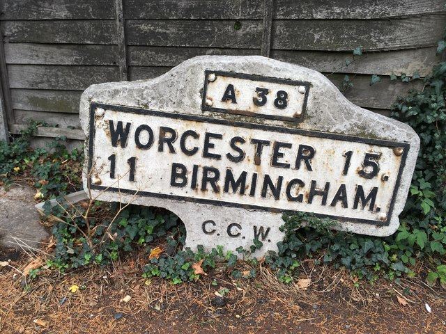
Image: © Jan Scrine Taken: 13 Aug 2020
Metal plate attached to concrete post by the A38, in parish of Lickey (Bromsgrove District), Lower Marlbrook, N of M42 Jct 1, in pavement, at end of crash barrier, back to wooden fence, on East side of road. Bradley post erected by the County Council in the 20th century. Inscription reads: // A38 / WORCESTER 15. / 11 BIRMINGHAM. / C.C.W. //. Not listed by Historic England. NGR: SO 96922 74253: Milestone Society National ID: WO_WOBM15. From National Survey of Wayside Features by The Milestone Society. https://www.milestonesociety.co.uk/
Images are licensed for reuse under creativecommons.org/licenses/by-sa/2.0
Image Location
Latitude
52.366292
Longitude
-2.046658