Victorian terrace on West Park
Introduction
The photograph on this page of Victorian terrace on West Park by Gordon Hatton as part of the Geograph project.
The Geograph project started in 2005 with the aim of publishing, organising and preserving representative images for every square kilometre of Great Britain, Ireland and the Isle of Man.

There are currently over 7.5m images from over 14,400 individuals and you can help contribute to the project by visiting https://www.geograph.org.uk
Victorian terrace on West Park
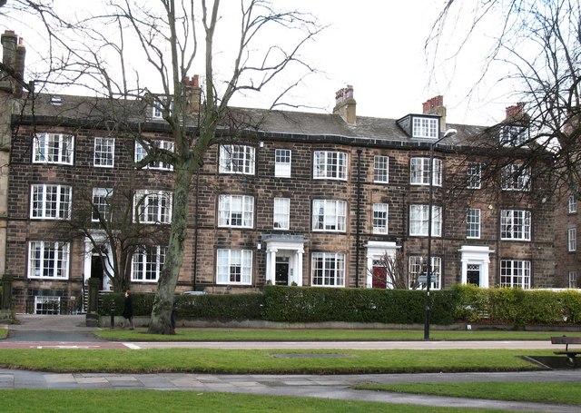
Image: © Gordon Hatton Taken: 9 Jan 2008
An attractive terrace of dark sandstone houses on West Park overlooking The Stray. The restrained style and classical doorways suggest an early date, and they appear to be named as 'Brunswick Terrace' on an 1849 map of the town.
Images are licensed for reuse under creativecommons.org/licenses/by-sa/2.0
Image Location


Leaflet Map data © OpenStreetMap
Latitude
53.989895
Longitude
-1.539978