Rothes from Conerock
Introduction
The photograph on this page of Rothes from Conerock by Anne Burgess as part of the Geograph project.
The Geograph project started in 2005 with the aim of publishing, organising and preserving representative images for every square kilometre of Great Britain, Ireland and the Isle of Man.

There are currently over 7.5m images from over 14,400 individuals and you can help contribute to the project by visiting https://www.geograph.org.uk
Rothes from Conerock
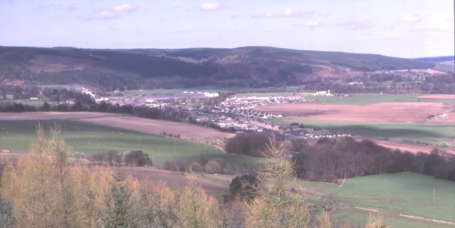
Image: © Anne Burgess Taken: Unknown
The 18th century town of Rothes is expanding on to the haugh or flood plain of the River Spey. Not surprisingly, flooding is becoming a problem for residents.
Images are licensed for reuse under creativecommons.org/licenses/by-sa/2.0
Image Location


Leaflet Map data © OpenStreetMap
Latitude
57.526718
Longitude
-3.207594