Former Ty'r Moerwydd Centre
Introduction
The photograph on this page of Former Ty'r Moerwydd Centre by Colin Cheesman as part of the Geograph project.
The Geograph project started in 2005 with the aim of publishing, organising and preserving representative images for every square kilometre of Great Britain, Ireland and the Isle of Man.

There are currently over 7.5m images from over 14,400 individuals and you can help contribute to the project by visiting https://www.geograph.org.uk
Former Ty'r Moerwydd Centre
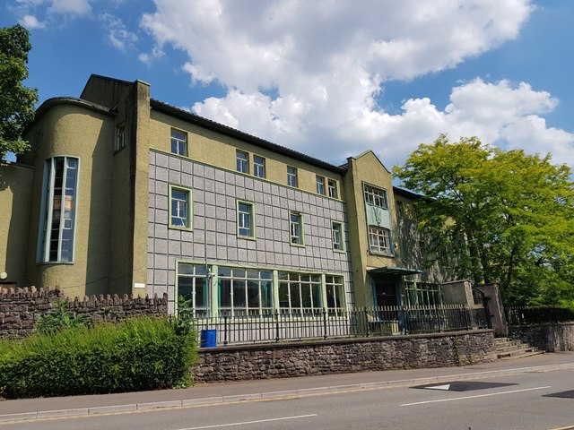
Image: © Colin Cheesman Taken: 25 Jun 2020
Next door to the right of this photograph is a 17th century house named Ty'r Moerwydd or House of the Birch which has been listed by Cadw. In 1904 it became a convent for Breton nuns who opened a girls school. In 1956 this imptressive extension was added to the school. It later became an Outdoor Education Centre owned by a London Borough until it closed a number of years ago. Its future is undecided though new houses are being constructed to the rear in the former open space and car park.
Images are licensed for reuse under creativecommons.org/licenses/by-sa/2.0
Image Location
Latitude
51.826747
Longitude
-3.021335