Old Milestone with modern plate by the A66, south east of Crackenthorpe
Introduction
The photograph on this page of Old Milestone with modern plate by the A66, south east of Crackenthorpe by Terry Moore as part of the Geograph project.
The Geograph project started in 2005 with the aim of publishing, organising and preserving representative images for every square kilometre of Great Britain, Ireland and the Isle of Man.

There are currently over 7.5m images from over 14,400 individuals and you can help contribute to the project by visiting https://www.geograph.org.uk
Old Milestone with modern plate by the A66, south east of Crackenthorpe
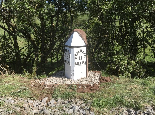
Image: © Terry Moore Taken: 7 May 2020
Old Stone post with replacement plate by the A66, in parish of CRACKENTHORPE (EDEN District), 100m East of village junction, North of Holme Lea and North East of Crackenthorpe Hall. Was at Image but moved when route of A66 altered, on North side of road. Originally Appleby plate, erected by the Brough & Eamont Bridge turnpike trust in the 19th century. The modern plate was cast in alloy in 2020. Inscription reads:- : APPLEBY / 2 MILES : : PENRITH 11 MILES : : BOWERBANK / PENRITH : Listed. Milestone Society National ID: WE_PRAP11R.
Images are licensed for reuse under creativecommons.org/licenses/by-sa/2.0
Image Location
Latitude
54.591164
Longitude
-2.521486