Nash Point Lighthouse
Introduction
The photograph on this page of Nash Point Lighthouse by Philip Cornwall as part of the Geograph project.
The Geograph project started in 2005 with the aim of publishing, organising and preserving representative images for every square kilometre of Great Britain, Ireland and the Isle of Man.

There are currently over 7.5m images from over 14,400 individuals and you can help contribute to the project by visiting https://www.geograph.org.uk
Nash Point Lighthouse
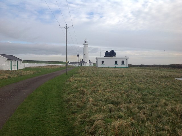
Image: © Philip Cornwall Taken: 2 Dec 2012
Nash Point Lighthouse (Wikipedia) https://en.wikipedia.org/wiki/Nash_Point The Nash Point Lighthouse is a Grade II listed building, dating from 1831–32. There are two lights, a high light and a low light, located at a distance of around 300 metres from one another. The leading light was removed during the 1920s because of the shifting location of the Nash sandbank. The lighthouse was designed by James Walker, the chief engineer for Trinity House. Its construction is said to have been spurred by the wreck of The Frolic on the Nash Sands in March 1831, which resulted in over 50 deaths, including that of Lt-Col N McLeod. The ship was on its way from Bristol to Haverfordwest. First lit in 1832, the lighthouse was electrified in 1968. Nash Point Lighthouse became the last manned lighthouse in Wales, and was automated in 1998. The lighthouse is now open to visitors, and is often used as a wedding venue; Trinity House provides public tours. The fog signal, no longer needed by ships, is sounded on the first Saturday and third Sunday of each month as an additional attraction to visitors. Currently, cottages around the lighthouse can be rented out as holiday accommodation.
Images are licensed for reuse under creativecommons.org/licenses/by-sa/2.0
Image Location
Latitude
51.400915
Longitude
-3.552493