Bridge pillar, Arlington House estate
Introduction
The photograph on this page of Bridge pillar, Arlington House estate by Chris as part of the Geograph project.
The Geograph project started in 2005 with the aim of publishing, organising and preserving representative images for every square kilometre of Great Britain, Ireland and the Isle of Man.

There are currently over 7.5m images from over 14,400 individuals and you can help contribute to the project by visiting https://www.geograph.org.uk
Bridge pillar, Arlington House estate
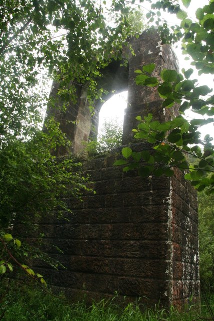
Image: © Chris Taken: 25 Jul 2020
In the valley bottom the River Yeo is dammed to form a serpentine lake c 650m south-west of the house. Created for Sir John Chichester in 1837, the lake was extended to its present size in 1851 when the two surviving stone pylon supports for the projected bridge designed by William Dredge of Bath were built on the site of the original dam. The bridge was never built (Sir John died). See https://historicengland.org.uk/listing/the-list/list-entry/1000687
Images are licensed for reuse under creativecommons.org/licenses/by-sa/2.0
Image Location
Latitude
51.145415
Longitude
-3.998118