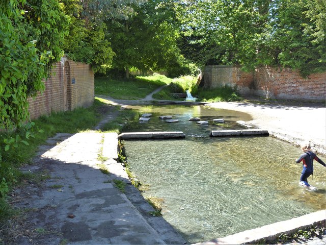
Market Lavington features [2]
Introduction
The photograph on this page of Market Lavington features [2] by Michael Dibb as part of the Geograph project.
The Geograph project started in 2005 with the aim of publishing, organising and preserving representative images for every square kilometre of Great Britain, Ireland and the Isle of Man.
There are currently over 7.5m images from over 14,400 individuals and you can help contribute to the project by visiting https://www.geograph.org.uk

Image: © Michael Dibb Taken: 19 May 2020
The Broadwell is a rectangular pond enclosure from the 17th or 18th century rebuilt in 1892 with stone surround and sluice at lower end, leading to lower pond. Formerly two dipping wells and pumps used by the blacksmith in the adjacent forge. Listed, grade II, with details at: https://historicengland.org.uk/listing/the-list/list-entry/1035855 Market Lavington lies at the foot of the north western scarp slope of Salisbury Plain, about 5 miles south of Devizes. There is evidence of continuous occupation of the village since the Iron Age and maybe, near continuous occupation since late Neolithic times. The village developed around the cross roads of an east-west road (now the B3098) and a north-south road which ran from Devizes to Salisbury – later closed. Once considered a town, a market charter was granted in 1254.

