Access Ramp, Collywell Bay, Seaton Sluice
Introduction
The photograph on this page of Access Ramp, Collywell Bay, Seaton Sluice by Geoff Holland as part of the Geograph project.
The Geograph project started in 2005 with the aim of publishing, organising and preserving representative images for every square kilometre of Great Britain, Ireland and the Isle of Man.

There are currently over 7.5m images from over 14,400 individuals and you can help contribute to the project by visiting https://www.geograph.org.uk
Access Ramp, Collywell Bay, Seaton Sluice
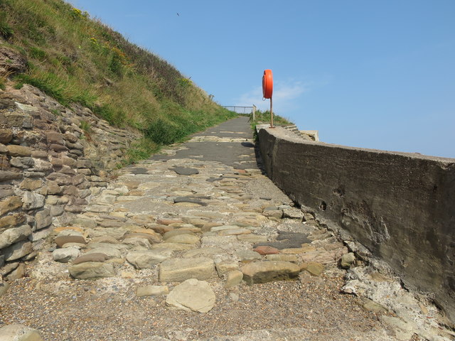
Image: © Geoff Holland Taken: 11 Aug 2020
This ramp gives access to and egress from the pebble beach named on the 1865 first edition of the Ordnance Survey Six-Inch map of the area as 'Collywell Sands' after the well which stood here called (unsurprisingly), 'Colly Well'. It also gives access to Charley's Garden https://www.geograph.org.uk/photo/6567417 an isolated sandstone stack which acquired its name from a local villager, Mr Charles Dockwray, who had cultivated a cliff-top garden prior to the sea eroding the rocks between the garden and the mainland and thus separating them for ever more. For a selection of detailed free to download walking routes in the area visit www.northtynesidewalks.co.uk
Images are licensed for reuse under creativecommons.org/licenses/by-sa/2.0
Image Location
Latitude
55.082246
Longitude
-1.470828