Whitefaulds Avenue 1971
Introduction
The photograph on this page of Whitefaulds Avenue 1971 by Mary and Angus Hogg as part of the Geograph project.
The Geograph project started in 2005 with the aim of publishing, organising and preserving representative images for every square kilometre of Great Britain, Ireland and the Isle of Man.

There are currently over 7.5m images from over 14,400 individuals and you can help contribute to the project by visiting https://www.geograph.org.uk
Whitefaulds Avenue 1971
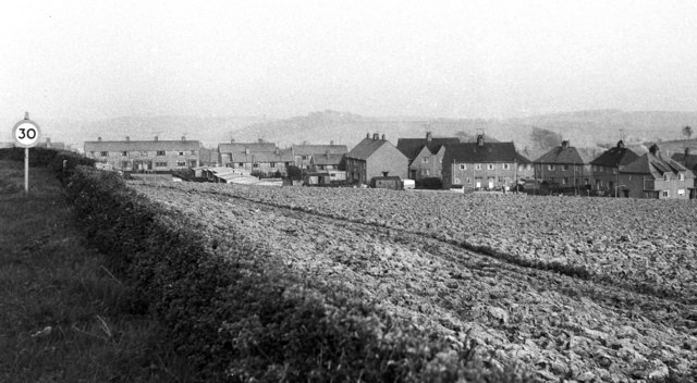
Image: © Mary and Angus Hogg Taken: Unknown
This view looks towards the back of the council houses in Whitefaulds Avenue. Points of interest include the prefabs and the amount of smoke coming from coal fires. The field in the foreground now holds modern housing Image which makes this view impossible to update. The 30mph sign has been moved further along the road beyond the new housing. During the summer of 1971, a Corncrake was heard calling in the field.
Images are licensed for reuse under creativecommons.org/licenses/by-sa/2.0
Image Location
Latitude
55.352967
Longitude
-4.692111