The Satyr's Temple, Castle Hill Estate
Introduction
The photograph on this page of The Satyr's Temple, Castle Hill Estate by Chris as part of the Geograph project.
The Geograph project started in 2005 with the aim of publishing, organising and preserving representative images for every square kilometre of Great Britain, Ireland and the Isle of Man.

There are currently over 7.5m images from over 14,400 individuals and you can help contribute to the project by visiting https://www.geograph.org.uk
The Satyr's Temple, Castle Hill Estate
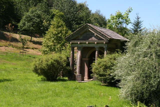
Image: © Chris Taken: 22 Jul 2020
Gravel walks extend west and north-west following the east bank of the Filleigh Brook in the valley west of the house, leading some 260m north-west to a group of three early C18 structures, the Sybil's Cave, the Satyr's Temple (listed grade II) and the Ugly Bridge (listed grade II) which serves to connect them across a serpentine 'river' and cascade...the Ugly Bridge is similarly rustic in style, while the Satyr's Temple has a Doric pedimented facade originally flanked by a pair of rustic stone blind arches, now partly decayed. This group of structures on the Filleigh Brook formed part of Earl Clinton's early C18 landscape, together with a Chinese Temple (now gone) which stood c 30m north-east on the site of a relocated C18 lead figure of Pan. See https://historicengland.org.uk/listing/the-list/list-entry/1000120
Images are licensed for reuse under creativecommons.org/licenses/by-sa/2.0
Image Location
Latitude
51.042211
Longitude
-3.898808