Phoenix Park tram terminus
Introduction
The photograph on this page of Phoenix Park tram terminus by Stephen McKay as part of the Geograph project.
The Geograph project started in 2005 with the aim of publishing, organising and preserving representative images for every square kilometre of Great Britain, Ireland and the Isle of Man.

There are currently over 7.5m images from over 14,400 individuals and you can help contribute to the project by visiting https://www.geograph.org.uk
Phoenix Park tram terminus
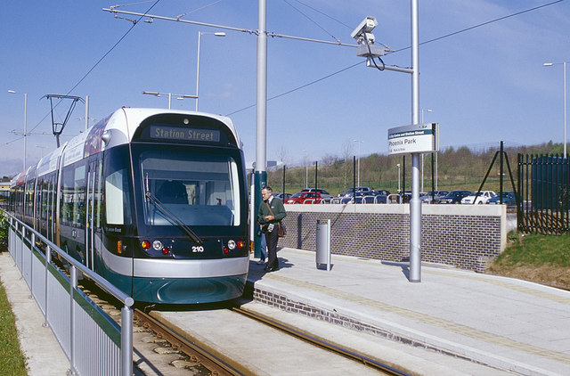
Image: © Stephen McKay Taken: Unknown
The Nottingham Express Transit system had been open just over a year when this photograph was taken in 2005. At that time trams only ran between Station Street and two outer termini at Hucknall and here at Phoenix Park, which offered park and ride facilities. The Phoenix Park terminus was built on the site of Cinderhill Colliery, which closed in 1986, and the tramway branch follows the route of the railway that served the colliery.
Images are licensed for reuse under creativecommons.org/licenses/by-sa/2.0
Image Location
Latitude
52.988795
Longitude
-1.206414