Stop lock
Introduction
The photograph on this page of Stop lock by Richard Sutcliffe as part of the Geograph project.
The Geograph project started in 2005 with the aim of publishing, organising and preserving representative images for every square kilometre of Great Britain, Ireland and the Isle of Man.

There are currently over 7.5m images from over 14,400 individuals and you can help contribute to the project by visiting https://www.geograph.org.uk
Stop lock
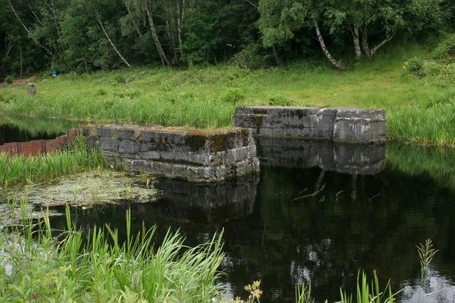
Image: © Richard Sutcliffe Taken: 25 Jun 2019
Built during World War II, this was one of three similar structures which were constructed to allow sections of the Glasgow Branch of the Forth and Clyde Canal to be shut off in the event of bomb damage to the canal.
Images are licensed for reuse under creativecommons.org/licenses/by-sa/2.0
Image Location
Latitude
55.881258
Longitude
-4.26759