Lady Pitt's Bridge
Introduction
The photograph on this page of Lady Pitt's Bridge by Jonathan Wilkins as part of the Geograph project.
The Geograph project started in 2005 with the aim of publishing, organising and preserving representative images for every square kilometre of Great Britain, Ireland and the Isle of Man.

There are currently over 7.5m images from over 14,400 individuals and you can help contribute to the project by visiting https://www.geograph.org.uk
Lady Pitt's Bridge
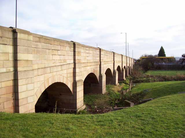
Image: © Jonathan Wilkins Taken: 30 Dec 2007
A very grand sandstone edifice to cross a very insignificant-looking ditch by the retail park. An absolutely vital link at times of flooding on the Don, of course. The main road to the North (was the A1, now by-passed) is now a dual-carriageway, but the southbound carriageway is carried on a set of crude Armco tubes, not visible here.
Images are licensed for reuse under creativecommons.org/licenses/by-sa/2.0
Image Location
Latitude
53.531449
Longitude
-1.152103