East Kennett features [1]
Introduction
The photograph on this page of East Kennett features [1] by Michael Dibb as part of the Geograph project.
The Geograph project started in 2005 with the aim of publishing, organising and preserving representative images for every square kilometre of Great Britain, Ireland and the Isle of Man.

There are currently over 7.5m images from over 14,400 individuals and you can help contribute to the project by visiting https://www.geograph.org.uk
East Kennett features [1]
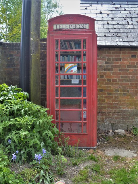
Image: © Michael Dibb Taken: 15 May 2020
The telephone box is now the village library. The box is a K6 type, designed in 1935 by Sir Giles Gilbert Scott. Listed, grade II, with details at: https://historicengland.org.uk/listing/the-list/list-entry/1262822 East Kennett is a small former agricultural village that lies 5 miles west of Marlborough near the River Kennet. South of the village is a cemetery containing East Kennett long barrow and a number of round barrows.
Images are licensed for reuse under creativecommons.org/licenses/by-sa/2.0
Image Location


Leaflet Map data © OpenStreetMap
Latitude
51.406495
Longitude
-1.831312