Flush Bracket Bench Mark on Triangulation Pillar near Green Hailey
Introduction
The photograph on this page of Flush Bracket Bench Mark on Triangulation Pillar near Green Hailey by David Hillas as part of the Geograph project.
The Geograph project started in 2005 with the aim of publishing, organising and preserving representative images for every square kilometre of Great Britain, Ireland and the Isle of Man.

There are currently over 7.5m images from over 14,400 individuals and you can help contribute to the project by visiting https://www.geograph.org.uk
Flush Bracket Bench Mark on Triangulation Pillar near Green Hailey
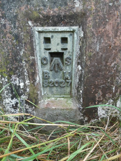
Image: © David Hillas Taken: 6 Aug 2020
This photo shows the flush bracket benchmark number S2027 on a triangulation pillar at the edge of a field at the junction of Kop Hill and Peters Lane https://www.geograph.org.uk/photo/6561671 refers.
Images are licensed for reuse under creativecommons.org/licenses/by-sa/2.0
Image Location


Leaflet Map data © OpenStreetMap
Latitude
51.723902
Longitude
-0.808024