Old Boundary Marker
Introduction
The photograph on this page of Old Boundary Marker by C Brash as part of the Geograph project.
The Geograph project started in 2005 with the aim of publishing, organising and preserving representative images for every square kilometre of Great Britain, Ireland and the Isle of Man.

There are currently over 7.5m images from over 14,400 individuals and you can help contribute to the project by visiting https://www.geograph.org.uk
Old Boundary Marker
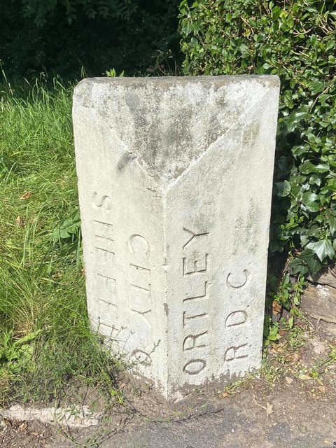
Image: © C Brash Taken: 3 Aug 2020
Municipal Boundary Marker in the inside of the pavement on the west side of the A61 Halifax Road, just north of the junction with Cowper Avenue. On the former boundary of Sheffield and Wortley, but now entirely in the City of Sheffield. Inscribed CITY OF / SHEFFIELD (vertically) and WORTLEY / R D C (vertically) on adjacent faces. Milestone Society National ID: YW_SHF04pb
Images are licensed for reuse under creativecommons.org/licenses/by-sa/2.0
Image Location
Latitude
53.431274
Longitude
-1.49186