Jennings Road
Introduction
The photograph on this page of Jennings Road by Ian Capper as part of the Geograph project.
The Geograph project started in 2005 with the aim of publishing, organising and preserving representative images for every square kilometre of Great Britain, Ireland and the Isle of Man.

There are currently over 7.5m images from over 14,400 individuals and you can help contribute to the project by visiting https://www.geograph.org.uk
Jennings Road
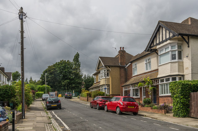
Image: © Ian Capper Taken: 25 Jul 2020
Houses in Jennings Road, the two seen here first appearing on the 1924 1:2,500 map. In the background can be seen the end of the road where it meets the railway, with on the left a footbridge connecting it with Lemsford Road - this was marked on the 1898 1:2,500 map, before the road was laid out, carrying a pre-existing footpath over the railway. For closer view see Image
Images are licensed for reuse under creativecommons.org/licenses/by-sa/2.0
Image Location
Latitude
51.75691
Longitude
-0.323765