"St Albans Postboxes"
Introduction
The photograph on this page of "St Albans Postboxes" by Ian Capper as part of the Geograph project.
The Geograph project started in 2005 with the aim of publishing, organising and preserving representative images for every square kilometre of Great Britain, Ireland and the Isle of Man.

There are currently over 7.5m images from over 14,400 individuals and you can help contribute to the project by visiting https://www.geograph.org.uk
"St Albans Postboxes"
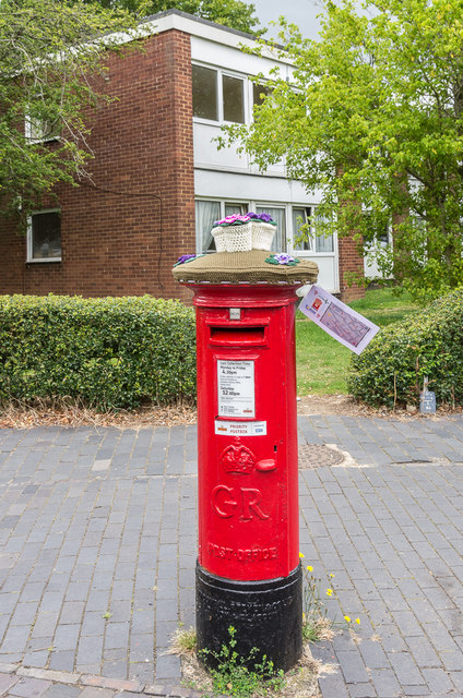
Image: © Ian Capper Taken: 25 Jul 2020
Postbox at the corner of Manor Road and Lemsford Road, with one of the blocks of flats in Thirsltane behind. The postbox is one of 12 "yarnbombed" boxes in St Albans, part of an initiative known as "St Albans postboxes" started at Christmas 2018. For summer 2020, each box topper has a floral theme with the year's specific objective being to raise money for two charities, Open Doors and the St Albans and District Foodbank. The design of this one was by Lucy Dronfield and sponsored by two local businesses, Sleep Time Baby and Centred Mums.
Images are licensed for reuse under creativecommons.org/licenses/by-sa/2.0
Image Location
Latitude
51.75465
Longitude
-0.327312