Par Bridge Level Crossing
Introduction
The photograph on this page of Par Bridge Level Crossing by Adrian Taylor as part of the Geograph project.
The Geograph project started in 2005 with the aim of publishing, organising and preserving representative images for every square kilometre of Great Britain, Ireland and the Isle of Man.

There are currently over 7.5m images from over 14,400 individuals and you can help contribute to the project by visiting https://www.geograph.org.uk
Par Bridge Level Crossing
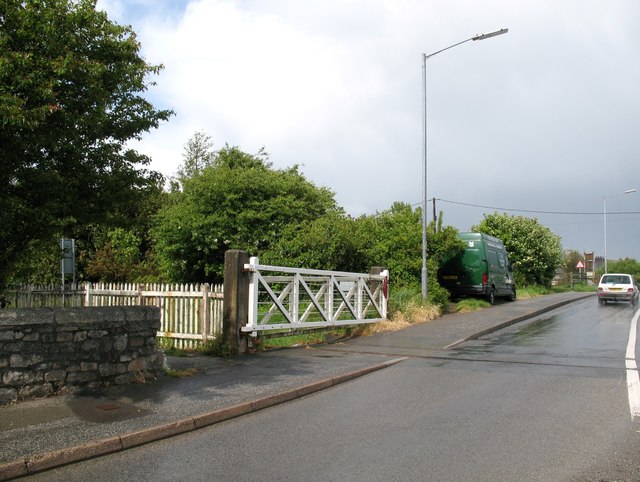
Image: © Adrian Taylor Taken: 16 May 2009
On the little used line from St. Blazey to Par Harbour, Par Bridge Level Crossing is 252 miles and 44 chains from the London Paddington station zero point, measured via Box and Bristol. The level crossing is unusual in having the hand operated gates folded back against each other either side of the A3082 road when closed to the railway. This is because the A3082 road is much wider here than the railway formation and four gates are required to close the road. There is a green National Trust van parked beyond the crossing.
Images are licensed for reuse under creativecommons.org/licenses/by-sa/2.0
Image Location
Latitude
50.350039
Longitude
-4.707608