Old Wayside Cross
Introduction
The photograph on this page of Old Wayside Cross by L Nott as part of the Geograph project.
The Geograph project started in 2005 with the aim of publishing, organising and preserving representative images for every square kilometre of Great Britain, Ireland and the Isle of Man.

There are currently over 7.5m images from over 14,400 individuals and you can help contribute to the project by visiting https://www.geograph.org.uk
Old Wayside Cross
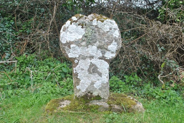
Image: © L Nott Taken: 14 Mar 2020
Pendrea Cross, a moved wayside cross with an old head and neck. Set on the southeast side of the B3283 southwest of the village in St Buryan parish. Grade II Listed https://historicengland.org.uk/listing/the-list/list-entry/1327474. See also http://www.flickr.com/photos/ocifant/412956008 and http://www.geograph.org.uk/photo/4785363. Milestone Society National ID: CWPW_SBU13
Images are licensed for reuse under creativecommons.org/licenses/by-sa/2.0
Image Location
Latitude
50.071446
Longitude
-5.626607