Cadoxton Place and St Raphaels Court
Introduction
The photograph on this page of Cadoxton Place and St Raphaels Court by Ian Capper as part of the Geograph project.
The Geograph project started in 2005 with the aim of publishing, organising and preserving representative images for every square kilometre of Great Britain, Ireland and the Isle of Man.

There are currently over 7.5m images from over 14,400 individuals and you can help contribute to the project by visiting https://www.geograph.org.uk
Cadoxton Place and St Raphaels Court
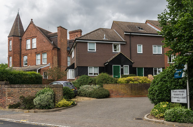
Image: © Ian Capper Taken: 24 Jul 2020
Buildings on Avenue Road. Cadoxton Place, on the left, is a distinctive house built in the late 19th Century, originally named St Raphael's. Until 2010 this was a home for the blind; it has since been subdivided into flats and renamed. St Raphaels Court, on the right, was built in the 1980s to provide additional accommodation for the home, but is now in general residential use.
Images are licensed for reuse under creativecommons.org/licenses/by-sa/2.0
Image Location
Latitude
51.757884
Longitude
-0.32838