Old Boundary Marker
Introduction
The photograph on this page of Old Boundary Marker by D Garside as part of the Geograph project.
The Geograph project started in 2005 with the aim of publishing, organising and preserving representative images for every square kilometre of Great Britain, Ireland and the Isle of Man.

There are currently over 7.5m images from over 14,400 individuals and you can help contribute to the project by visiting https://www.geograph.org.uk
Old Boundary Marker
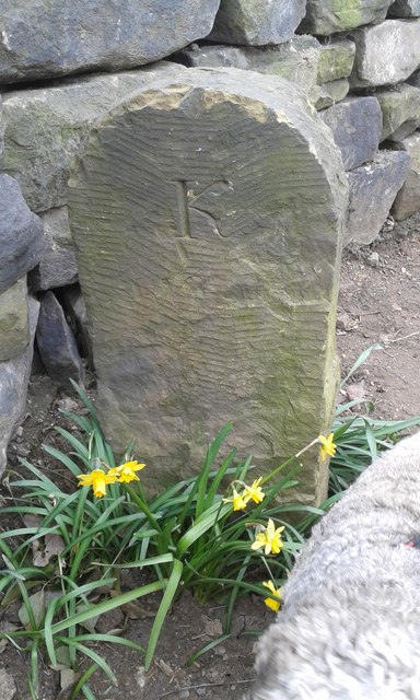
Image: © D Garside Taken: 5 Apr 2020
Parish Boundary Marker beside a public footpath at Boyle Hall. On the former boundary of Mirfield and Kirkheaton, now Kirkburton and Mirfield parishes. Inscribed M and K on opposite faces. Milestone Society National ID: YW_KIRMIR04pb
Images are licensed for reuse under creativecommons.org/licenses/by-sa/2.0
Image Location
Latitude
53.672816
Longitude
-1.709094