Old Boundary Marker on Norton Bridge, near Wath
Introduction
The photograph on this page of Old Boundary Marker on Norton Bridge, near Wath by M Hatton as part of the Geograph project.
The Geograph project started in 2005 with the aim of publishing, organising and preserving representative images for every square kilometre of Great Britain, Ireland and the Isle of Man.

There are currently over 7.5m images from over 14,400 individuals and you can help contribute to the project by visiting https://www.geograph.org.uk
Old Boundary Marker on Norton Bridge, near Wath
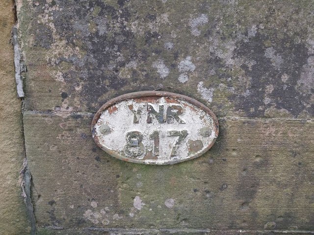
Image: © M Hatton Taken: 28 Mar 2020
Bridge Marker on the east end of the south bridge parapet of Norton Bridge, Norton Beck. Norton Conyers parish. YNR / 817 in raised lettering. Milestone Society National ID: YN_NORCON01br
Images are licensed for reuse under creativecommons.org/licenses/by-sa/2.0
Image Location
Latitude
54.187056
Longitude
-1.508217