St. Pauls, Long Lane
Introduction
The photograph on this page of St. Pauls, Long Lane by Martin Addison as part of the Geograph project.
The Geograph project started in 2005 with the aim of publishing, organising and preserving representative images for every square kilometre of Great Britain, Ireland and the Isle of Man.

There are currently over 7.5m images from over 14,400 individuals and you can help contribute to the project by visiting https://www.geograph.org.uk
St. Pauls, Long Lane
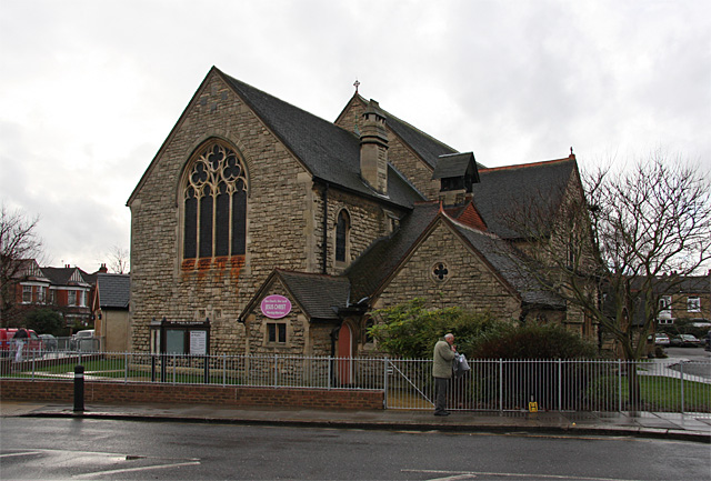
Image: © Martin Addison Taken: 11 Jan 2008
Located on the corner of Dukes Avenue. The pattern of the roofs on this church has always fascinated me. It was built in 1885 but was never completed. It was intended that there would be a spire, which is probably why the proportions of the church look a bit strange. I assume that the spire would have been at the west end of the church.
Images are licensed for reuse under creativecommons.org/licenses/by-sa/2.0
Image Location
Latitude
51.603286
Longitude
-0.186801