Islamic Centre, Rhyl
Introduction
The photograph on this page of Islamic Centre, Rhyl by Eirian Evans as part of the Geograph project.
The Geograph project started in 2005 with the aim of publishing, organising and preserving representative images for every square kilometre of Great Britain, Ireland and the Isle of Man.

There are currently over 7.5m images from over 14,400 individuals and you can help contribute to the project by visiting https://www.geograph.org.uk
Islamic Centre, Rhyl
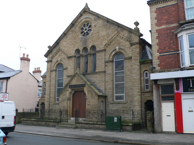
Image: © Eirian Evans Taken: 11 Jan 2008
A 19th century Baptist chapel which was bought by the small local Islamic community in the Rhyl area and which had now been converted into the Islamic Cultural Centre. It is in Water Street, Rhyl
Images are licensed for reuse under creativecommons.org/licenses/by-sa/2.0
Image Location
Latitude
53.321079
Longitude
-3.4922