Sheerland Farmhouse, Pluckley
Introduction
The photograph on this page of Sheerland Farmhouse, Pluckley by pam fray as part of the Geograph project.
The Geograph project started in 2005 with the aim of publishing, organising and preserving representative images for every square kilometre of Great Britain, Ireland and the Isle of Man.

There are currently over 7.5m images from over 14,400 individuals and you can help contribute to the project by visiting https://www.geograph.org.uk
Sheerland Farmhouse, Pluckley
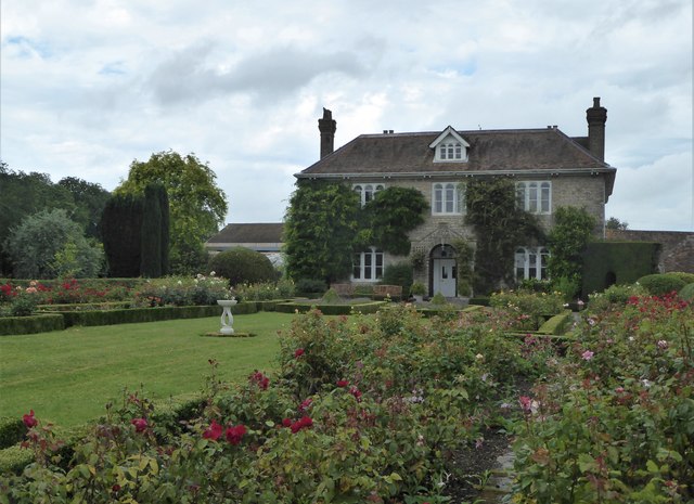
Image: © pam fray Taken: 27 Jul 2020
A grade II listed building with the round-topped Dering windows. It is part of the home farm of the Surrenden Dering estate and was built in 1813.Dering windows are found in Pluckley and surrounding areas, and named after the Dering family. They are identified by their round tops above each casement. It is said that during the civil war (1642-1652) one of the Royalist members of the Dering family escaped through one of these windows. Considering them lucky, Sir Edward Cholmeley Dering had all the windows on the Dering estate made to the same pattern.
Images are licensed for reuse under creativecommons.org/licenses/by-sa/2.0
Image Location
Latitude
51.174616
Longitude
0.764056