Old Boundary Marker
Introduction
The photograph on this page of Old Boundary Marker by M Chitty, Wavertree Society as part of the Geograph project.
The Geograph project started in 2005 with the aim of publishing, organising and preserving representative images for every square kilometre of Great Britain, Ireland and the Isle of Man.

There are currently over 7.5m images from over 14,400 individuals and you can help contribute to the project by visiting https://www.geograph.org.uk
Old Boundary Marker
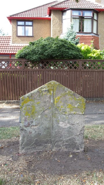
Image: © M Chitty, Wavertree Society Taken: 10 Aug 2018
Parish Boundary Marker on the north side of Green Lane, on the verge outside number 29. Liverpool metropolitan district. No inscription, just an inscribed vertical line. Showing the boundary of Wavertree and Allerton townships' responsibility for road maintenance. Reference http://www.liverpool.ndo.co.uk/wavsoc/news20/index.html. Milestone Society National ID: LA_LVWVAL01pb
Images are licensed for reuse under creativecommons.org/licenses/by-sa/2.0
Image Location
Latitude
53.385529
Longitude
-2.904471