
Kilmond Wood Quarry
Introduction
The photograph on this page of Kilmond Wood Quarry by Trevor Littlewood as part of the Geograph project.
The Geograph project started in 2005 with the aim of publishing, organising and preserving representative images for every square kilometre of Great Britain, Ireland and the Isle of Man.

There are currently over 7.5m images from over 14,400 individuals and you can help contribute to the project by visiting https://www.geograph.org.uk
Kilmond Wood Quarry
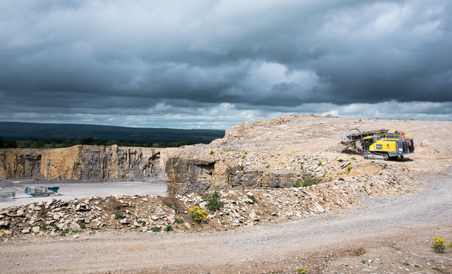
Image: © Trevor Littlewood Taken: 26 Jul 2020
Kilmond Wood Quarry is a large excavation into Carboniferous Limestone on the south side of the A66 near Barnard Castle. A public footpath runs to the south of it at the top of Kilmond Scar, a natural, south facing exposure of the same limestone and an SSSI. The trig point known to the OS as 'Kilmond Scar' will have stood somewhere beyond the large yellow machine but it was removed, stored and then replaced, (but not set properly into the ground), at a nearby location: http://www.geograph.org.uk/preview.php.
Images are licensed for reuse under creativecommons.org/licenses/by-sa/2.0
Image Location

Latitude
54.516253
Longitude
-1.960423