Old Boundary Marker
Introduction
The photograph on this page of Old Boundary Marker by D Phillips as part of the Geograph project.
The Geograph project started in 2005 with the aim of publishing, organising and preserving representative images for every square kilometre of Great Britain, Ireland and the Isle of Man.

There are currently over 7.5m images from over 14,400 individuals and you can help contribute to the project by visiting https://www.geograph.org.uk
Old Boundary Marker
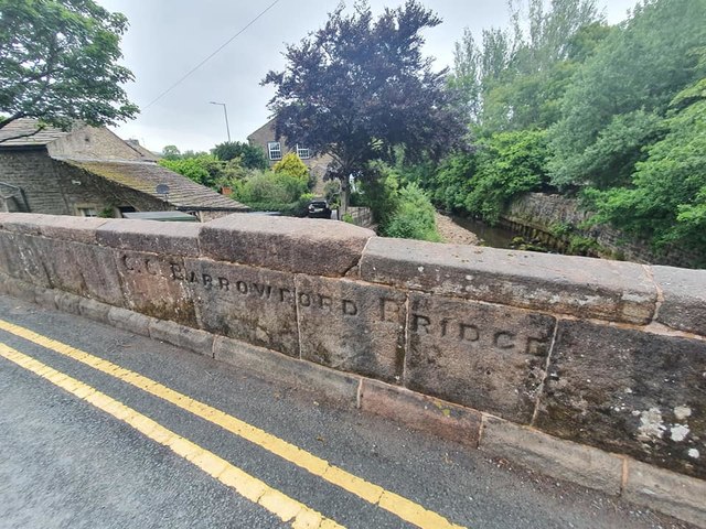
Image: © D Phillips Taken: 12 Jun 2020
Bridge Marker inscribed in the northeast side parapet of Barrowford Bridge, Pendle Water on B6247 Colne Road. Barrowford parish. Inscribed C C BARROWFORD BRIDGE. Milestone Society National ID: LA_BARR01br
Images are licensed for reuse under creativecommons.org/licenses/by-sa/2.0
Image Location


Leaflet Map data © OpenStreetMap
Latitude
53.854335
Longitude
-2.210453