Wellington Baptist Church
Introduction
The photograph on this page of Wellington Baptist Church by Bill Boaden as part of the Geograph project.
The Geograph project started in 2005 with the aim of publishing, organising and preserving representative images for every square kilometre of Great Britain, Ireland and the Isle of Man.

There are currently over 7.5m images from over 14,400 individuals and you can help contribute to the project by visiting https://www.geograph.org.uk
Wellington Baptist Church
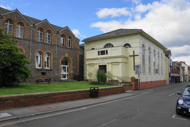
Image: © Bill Boaden Taken: 10 Jul 2020
A Grade II listed building dating from 1833, though I understand it replaced an earlier chapel. The building on the left is the Sunday School.
Images are licensed for reuse under creativecommons.org/licenses/by-sa/2.0
Image Location
Latitude
50.97737
Longitude
-3.22679