Charmandean Lane, Broadwater, Worthing
Introduction
The photograph on this page of Charmandean Lane, Broadwater, Worthing by Simon Carey as part of the Geograph project.
The Geograph project started in 2005 with the aim of publishing, organising and preserving representative images for every square kilometre of Great Britain, Ireland and the Isle of Man.

There are currently over 7.5m images from over 14,400 individuals and you can help contribute to the project by visiting https://www.geograph.org.uk
Charmandean Lane, Broadwater, Worthing
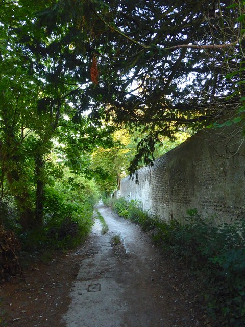
Image: © Simon Carey Taken: 22 Jul 2020
An old drove road heading north from the modern day A27. The flint wall on the right once separated the lane from Charman Dean, a large house that later became a girls school and was demolished in the 1960s to make way for a housing estate.
Images are licensed for reuse under creativecommons.org/licenses/by-sa/2.0
Image Location
Latitude
50.837565
Longitude
-0.371164