The Panny Path, Exeter
Introduction
The photograph on this page of The Panny Path, Exeter by Derek Harper as part of the Geograph project.
The Geograph project started in 2005 with the aim of publishing, organising and preserving representative images for every square kilometre of Great Britain, Ireland and the Isle of Man.

There are currently over 7.5m images from over 14,400 individuals and you can help contribute to the project by visiting https://www.geograph.org.uk
The Panny Path, Exeter
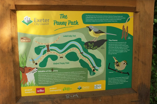
Image: © Derek Harper Taken: 18 Jul 2020
The Panny is an alternative name for the Northbrook, which is how the stream is shown on OS maps. The Panny Path Project, which ran between February and April 2019, involved improving the path alongside the stream and its environment http://ludwelllife.org.uk/panny-path/ . The stream borders Ludwell Valley Park.
Images are licensed for reuse under creativecommons.org/licenses/by-sa/2.0
Image Location
Latitude
50.708959
Longitude
-3.501191