Our Lady?s Flats, Church Hill
Introduction
The photograph on this page of Our Lady?s Flats, Church Hill by John Baker as part of the Geograph project.
The Geograph project started in 2005 with the aim of publishing, organising and preserving representative images for every square kilometre of Great Britain, Ireland and the Isle of Man.

There are currently over 7.5m images from over 14,400 individuals and you can help contribute to the project by visiting https://www.geograph.org.uk
Our Lady?s Flats, Church Hill
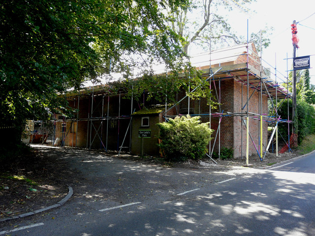
Image: © John Baker Taken: 28 Jun 2020
Planning permission has been granted by Dover District Council under application number DOV/19/01441 for a “change of use and conversion of former chapel to a single residential dwelling, incorporating external staircase, replacement windows, insertion of 5 roof lights and creation of parking”. This was Image, after the work had been completed. The building used to be the Image
Images are licensed for reuse under creativecommons.org/licenses/by-sa/2.0
Image Location
Latitude
51.201007
Longitude
1.261719