Gedling Country Park ? Can You See?
Introduction
The photograph on this page of Gedling Country Park ? Can You See? by Alan Murray-Rust as part of the Geograph project.
The Geograph project started in 2005 with the aim of publishing, organising and preserving representative images for every square kilometre of Great Britain, Ireland and the Isle of Man.

There are currently over 7.5m images from over 14,400 individuals and you can help contribute to the project by visiting https://www.geograph.org.uk
Gedling Country Park ? Can You See?
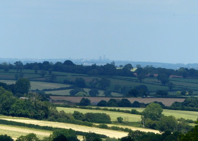
Image: © Alan Murray-Rust Taken: 16 Jul 2020
View from the northern viewpoint at the Park. The information board http://www.geograph.org.uk/photo/6543430 suggests that Lincoln Cathedral in Image is visible from here. At full zoom of the camera it is just possible to make out the Cathedral, which is 45 km distant. Interestingly when it was caught by the sun it virtually disappeared against the sky. The Westgate Water Tower is much less visible, just discernible a little way to the left of the cathedral, immediately above the rounded dark tree.
Images are licensed for reuse under creativecommons.org/licenses/by-sa/2.0
Image Location


Leaflet Map data © OpenStreetMap
Latitude
52.991722
Longitude
-1.07645