Flush Bracket Bench Mark on Triangulation Pillar near Prestwood
Introduction
The photograph on this page of Flush Bracket Bench Mark on Triangulation Pillar near Prestwood by David Hillas as part of the Geograph project.
The Geograph project started in 2005 with the aim of publishing, organising and preserving representative images for every square kilometre of Great Britain, Ireland and the Isle of Man.

There are currently over 7.5m images from over 14,400 individuals and you can help contribute to the project by visiting https://www.geograph.org.uk
Flush Bracket Bench Mark on Triangulation Pillar near Prestwood
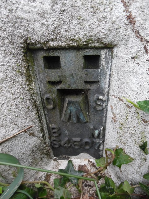
Image: © David Hillas Taken: 16 Jul 2020
This photo shows the flush bracket benchmark on the triangulation pillar East of Prestwood, https://www.geograph.org.uk/photo/6542744 refers. It has the letters OS (Ordnance Survey), BM (Bench Mark) and the number of the pillar S4507.
Images are licensed for reuse under creativecommons.org/licenses/by-sa/2.0
Image Location
Latitude
51.694734
Longitude
-0.727477