Cheltenham buildings [56]
Introduction
The photograph on this page of Cheltenham buildings [56] by Michael Dibb as part of the Geograph project.
The Geograph project started in 2005 with the aim of publishing, organising and preserving representative images for every square kilometre of Great Britain, Ireland and the Isle of Man.

There are currently over 7.5m images from over 14,400 individuals and you can help contribute to the project by visiting https://www.geograph.org.uk
Cheltenham buildings [56]
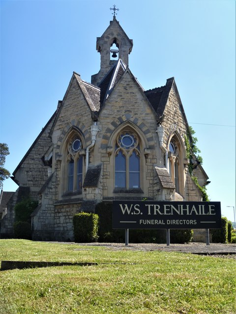
Image: © Michael Dibb Taken: 6 May 2020
This delightful former school was built in Gothic Revival, Early Decorated style to complement the adjacent church of the Holy Apostles. Constructed in 1873 with the ugly entrance range added in the 20th century. The building is now occupied by a firm of funeral directors. Other views of the building are at Image and Image Listed, grade II, with details at: https://historicengland.org.uk/listing/the-list/list-entry/1386622 Cheltenham is located at the foot of the Cotswold scarp with the small River Chelt flowing through the town. After the discovery of mineral springs in 1716 Cheltenham became a spa town and many Regency houses and other buildings were erected. The town is home to the renowned Cheltenham Festival, four days of horse jump racing culminating in the Gold Cup, held annually in March at the nearby racecourse.
Images are licensed for reuse under creativecommons.org/licenses/by-sa/2.0
Image Location


Leaflet Map data © OpenStreetMap
Latitude
51.890059
Longitude
-2.059674