The Cottage, 27 High Street, Nettleham
Introduction
The photograph on this page of The Cottage, 27 High Street, Nettleham by Jo and Steve Turner as part of the Geograph project.
The Geograph project started in 2005 with the aim of publishing, organising and preserving representative images for every square kilometre of Great Britain, Ireland and the Isle of Man.

There are currently over 7.5m images from over 14,400 individuals and you can help contribute to the project by visiting https://www.geograph.org.uk
The Cottage, 27 High Street, Nettleham
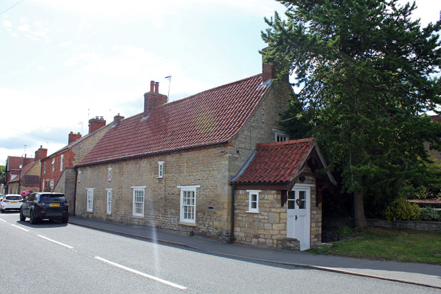
Image: © Jo and Steve Turner Taken: 14 Jul 2020
Grade II Listed late 17th century house with minor 18th and 20th century alterations. It is the first house with a well under it but most on this side of High Street to the Church Cemetery have their own well either under the house or in the garden. There is an underground stream under the houses which does not have an outfall. During excavations in 1978 significant evidence for Anglo-Saxon activity was found including two 9th century dress accessories.
Images are licensed for reuse under creativecommons.org/licenses/by-sa/2.0
Image Location
Latitude
53.264801
Longitude
-0.492738