Middle Farm, Seghill
Introduction
The photograph on this page of Middle Farm, Seghill by Geoff Holland as part of the Geograph project.
The Geograph project started in 2005 with the aim of publishing, organising and preserving representative images for every square kilometre of Great Britain, Ireland and the Isle of Man.

There are currently over 7.5m images from over 14,400 individuals and you can help contribute to the project by visiting https://www.geograph.org.uk
Middle Farm, Seghill
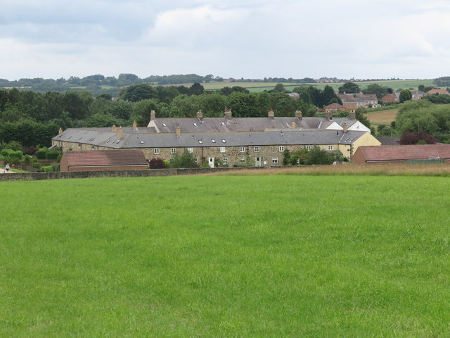
Image: © Geoff Holland Taken: 7 Jul 2020
The configuration of Middle Farm has changed little since the first Ordnance Survey Six-Inch map of the area was published in 1865 although the surrounding area has undergone massive change. The area immediately behind Middle Farm was once the site of Seghill Colliery which closed in 1962. The properties within Middle Farm are now utilised as private dwellings, many of which have been converted from various farm outbuildings. For a selection of detailed free to download walking routes in the area visit www.northtynesidewalks.co.uk
Images are licensed for reuse under creativecommons.org/licenses/by-sa/2.0
Image Location
Latitude
55.06981
Longitude
-1.551639