Burslem Cemetery Chapel (Demolished 2008)
Introduction
The photograph on this page of Burslem Cemetery Chapel (Demolished 2008) by Brian Deegan as part of the Geograph project.
The Geograph project started in 2005 with the aim of publishing, organising and preserving representative images for every square kilometre of Great Britain, Ireland and the Isle of Man.

There are currently over 7.5m images from over 14,400 individuals and you can help contribute to the project by visiting https://www.geograph.org.uk
Burslem Cemetery Chapel (Demolished 2008)
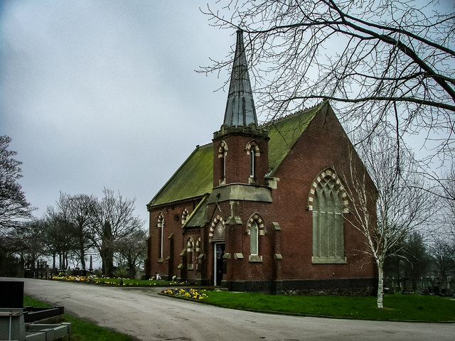
Image: © Brian Deegan Taken: 31 Mar 2005
Demolished at the end of 2008 The site in Nettlebank Smallthorne was opened in 1879 and covers about 28 acres. At a cost of £20,500. It was intended to be a recreation park for strolling about, and even riding and cycling. At least a third of the land was used for the lodges along the walks. In fact only about five and a half acres was specifically intended for burials. It was a pleasure park as well as a place for memorials and reflection. And the centrepiece was the chapel set in the middle. http://www.thepotteries.org/walks/lost_roads/20_burslem_cem.htm
Images are licensed for reuse under creativecommons.org/licenses/by-sa/2.0
Image Location
Latitude
53.045426
Longitude
-2.17567