Roadside wall in Tong Norton
Introduction
The photograph on this page of Roadside wall in Tong Norton by Richard Law as part of the Geograph project.
The Geograph project started in 2005 with the aim of publishing, organising and preserving representative images for every square kilometre of Great Britain, Ireland and the Isle of Man.

There are currently over 7.5m images from over 14,400 individuals and you can help contribute to the project by visiting https://www.geograph.org.uk
Roadside wall in Tong Norton
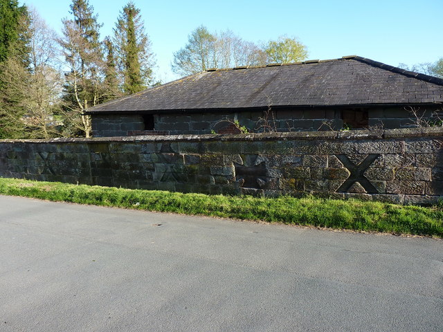
Image: © Richard Law Taken: 19 Apr 2020
At first glance nothing much to look at, but the right light picks out these rather unusual carvings or mouldings in the face of 50 metres of this wall. They are very similar to those seen in Image, which was once the boundary wall to the extensive grounds of Tong Castle, and it's entirely probable that this was constructed at the same time (or, and I'm speculating here, the wall has been relocated at some stage in its life). It dates to the late 18th or early 19th century, and was Grade II listed https://britishlistedbuildings.co.uk/101367652-wall-approximately-10-metres-to-north-of-byre-with-hayloft-at-tong-norton-farm-tong#.Xv-nCChKjcs & https://historicengland.org.uk/listing/the-list/list-entry/1367652 in 1984.
Images are licensed for reuse under creativecommons.org/licenses/by-sa/2.0
Image Location


Leaflet Map data © OpenStreetMap
Latitude
52.670483
Longitude
-2.306218