Old guidepost at the end of Constable Ridge Road
Introduction
The photograph on this page of Old guidepost at the end of Constable Ridge Road by Stephen Craven as part of the Geograph project.
The Geograph project started in 2005 with the aim of publishing, organising and preserving representative images for every square kilometre of Great Britain, Ireland and the Isle of Man.

There are currently over 7.5m images from over 14,400 individuals and you can help contribute to the project by visiting https://www.geograph.org.uk
Old guidepost at the end of Constable Ridge Road
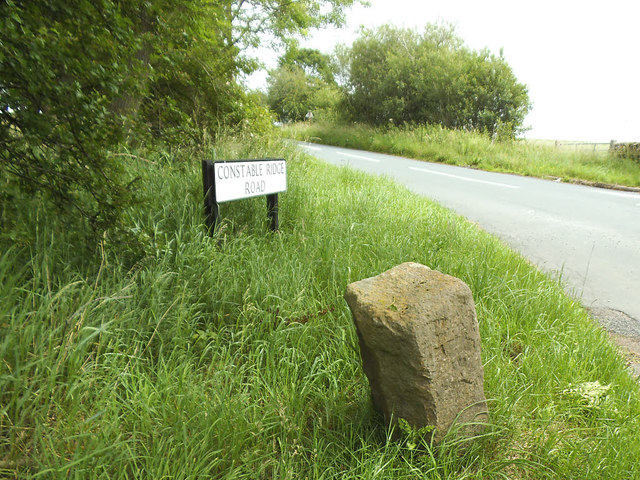
Image: © Stephen Craven Taken: 23 Jun 2020
This is shown as GP (guidepost) on old maps. A recently uploaded entry from the Milestone Society Image describes it as (the remains of) a wayside cross.
Images are licensed for reuse under creativecommons.org/licenses/by-sa/2.0
Image Location


Leaflet Map data © OpenStreetMap
Latitude
53.992751
Longitude
-1.670966