
Quaker burial ground [2]
Introduction
The photograph on this page of Quaker burial ground [2] by Gordon Hatton as part of the Geograph project.
The Geograph project started in 2005 with the aim of publishing, organising and preserving representative images for every square kilometre of Great Britain, Ireland and the Isle of Man.

There are currently over 7.5m images from over 14,400 individuals and you can help contribute to the project by visiting https://www.geograph.org.uk
Quaker burial ground [2]
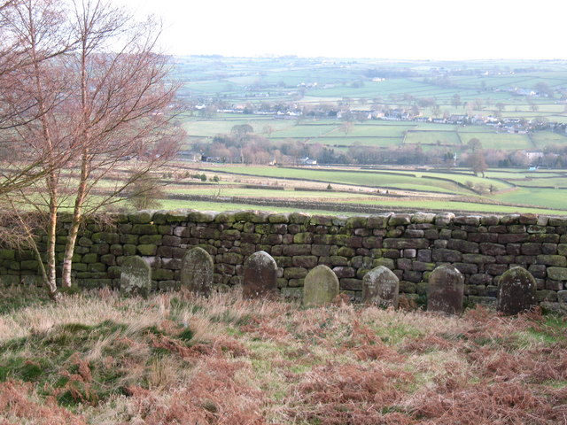
Image: © Gordon Hatton Taken: 6 Jan 2008
The first recorded burial on this site was in 1688 and the last in 1842. It is thought that over 140 people were buried here. Despite the number of burials, there are only two original stones visible. Those along the wall side appear to have been moved here recently from another old burial ground at nearby Darley. Even the gravestones reflect the plain and simple style preferred by the Quakers. A peaceful spot.
Images are licensed for reuse under creativecommons.org/licenses/by-sa/2.0
Image Location

Latitude
54.041489
Longitude
-1.715935