Radlett: Watling Street (1)
Introduction
The photograph on this page of Radlett: Watling Street (1) by Nigel Cox as part of the Geograph project.
The Geograph project started in 2005 with the aim of publishing, organising and preserving representative images for every square kilometre of Great Britain, Ireland and the Isle of Man.

There are currently over 7.5m images from over 14,400 individuals and you can help contribute to the project by visiting https://www.geograph.org.uk
Radlett: Watling Street (1)
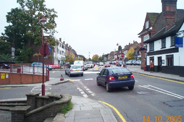
Image: © Nigel Cox Taken: 14 Oct 2005
A profusion of road signs and street furniture greets the motorist at this busy mini-roundabout at the junction of Watling Street with Shenley Hill. Viewed looking southwards along the Roman Road this was the old A5 but was downgraded to the A5183 some time ago. The stone column of Radlett's War Memorial is just visible to the left of the roundabout in front of the shops.
Images are licensed for reuse under creativecommons.org/licenses/by-sa/2.0
Image Location


Leaflet Map data © OpenStreetMap
Latitude
51.683107
Longitude
-0.317711