Direction Sign ? Signpost
Introduction
The photograph on this page of Direction Sign ? Signpost by S Kosciow as part of the Geograph project.
The Geograph project started in 2005 with the aim of publishing, organising and preserving representative images for every square kilometre of Great Britain, Ireland and the Isle of Man.

There are currently over 7.5m images from over 14,400 individuals and you can help contribute to the project by visiting https://www.geograph.org.uk
Direction Sign ? Signpost
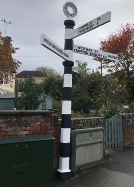
Image: © S Kosciow Taken: 20 Apr 2019
Located on the pavement on the east side of the junction of the B4060 Old Rectory Road, B4062 Charfield Road and B4060 Wotton Road, beside a brick wall, and next to the war memorial shelter in Kingswood parish. 3 replacement arms and annulus finial. See also http://www.geograph.org.uk/photo/5843614 and http://www.geograph.org.uk/photo/288231. Milestone Society National ID: GL_ST7492
Images are licensed for reuse under creativecommons.org/licenses/by-sa/2.0
Image Location
Latitude
51.626338
Longitude
-2.36778