Ludgate Hill, 1959
Introduction
The photograph on this page of Ludgate Hill, 1959 by David Wright as part of the Geograph project.
The Geograph project started in 2005 with the aim of publishing, organising and preserving representative images for every square kilometre of Great Britain, Ireland and the Isle of Man.

There are currently over 7.5m images from over 14,400 individuals and you can help contribute to the project by visiting https://www.geograph.org.uk
Ludgate Hill, 1959
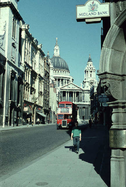
Image: © David Wright Taken: Unknown
Looking up Ludgate Hill towards St. Paul's. Picture taken in 1959 and scanned from an old Agfacolor slide. The bus is, I am advised, an RTL type (rarer than RT). It is a No. 6 going to Kensal Rise Station. Interesting to compare this with the 2005 picture.
Images are licensed for reuse under creativecommons.org/licenses/by-sa/2.0
Image Location


Leaflet Map data © OpenStreetMap
Latitude
51.51346
Longitude
-0.102024