Gammaton Barton
Introduction
The photograph on this page of Gammaton Barton by Derek Harper as part of the Geograph project.
The Geograph project started in 2005 with the aim of publishing, organising and preserving representative images for every square kilometre of Great Britain, Ireland and the Isle of Man.

There are currently over 7.5m images from over 14,400 individuals and you can help contribute to the project by visiting https://www.geograph.org.uk
Gammaton Barton
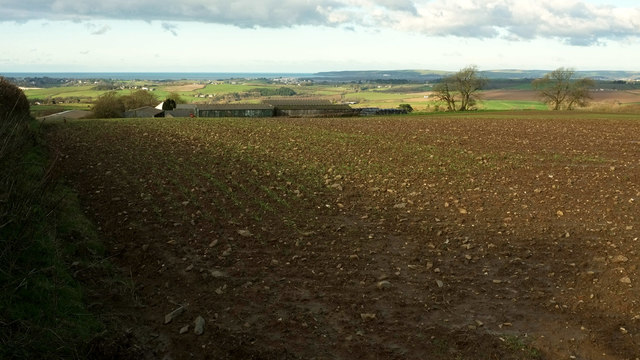
Image: © Derek Harper Taken: 1 Dec 2019
The cluster of farm buildings seen across an arable field. The tiny white triangle is the gable end of the farmhouse catching the sun. Just to the right of it, a pheasant is searching for whatever's been planted. A fine view beyond takes in Appledore in the centre near the confluence of the Torridge and the Taw, with Baggy Point in the distance.
Images are licensed for reuse under creativecommons.org/licenses/by-sa/2.0
Image Location
Latitude
51.007857
Longitude
-4.157701