Blue Waters Pond
Introduction
The photograph on this page of Blue Waters Pond by Derek Harper as part of the Geograph project.
The Geograph project started in 2005 with the aim of publishing, organising and preserving representative images for every square kilometre of Great Britain, Ireland and the Isle of Man.

There are currently over 7.5m images from over 14,400 individuals and you can help contribute to the project by visiting https://www.geograph.org.uk
Blue Waters Pond
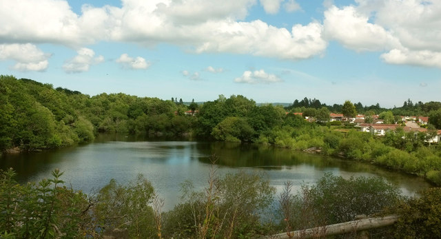
Image: © Derek Harper Taken: 14 Jun 2020
The lake fills a former lignite mine and clay pit, both used in the pottery industry here on the southern side of Bovey Tracey http://boveytraceyhistory.org.uk/topics/domestic-fuel-victorian/ . The extensive mine workings have now led to a problem for the residents of the adjacent New Park park home development (right), because, as Image] and Image] illustrate, Ashburton Road, from which this was taken, closed in March 2020 "after a landslip and a disused mining tunnel under the road was found to be in danger of collapsing" https://www.middevonadvertiser.co.uk/article.cfm?id=118894&headline=ELDERLY%20HIT%20BY%20FEARS%20OF%20ROAD%20COLLAPSE§ionIs=news&searchyear=2020 ; the road will remain closed to traffic until August 2021.
Images are licensed for reuse under creativecommons.org/licenses/by-sa/2.0
Image Location
Latitude
50.579719
Longitude
-3.679285