Ashburton Road, Bovey Tracey
Introduction
The photograph on this page of Ashburton Road, Bovey Tracey by Derek Harper as part of the Geograph project.
The Geograph project started in 2005 with the aim of publishing, organising and preserving representative images for every square kilometre of Great Britain, Ireland and the Isle of Man.

There are currently over 7.5m images from over 14,400 individuals and you can help contribute to the project by visiting https://www.geograph.org.uk
Ashburton Road, Bovey Tracey
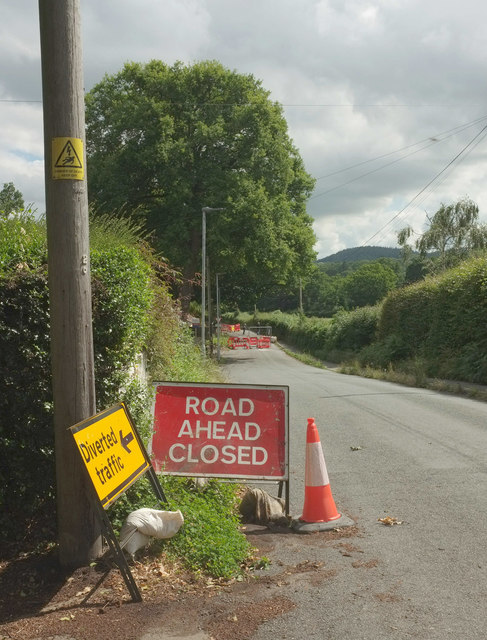
Image: © Derek Harper Taken: 14 Jun 2020
The road is closed to vehicles, probably until August 2021, but pedestrians and bikes can get past the barriers ahead. "Ashburton Road ... has been closed after a landslip and a disused mining tunnel under the road was found to be in danger of collapsing" https://www.middevonadvertiser.co.uk/article.cfm?id=118894&headline=ELDERLY%20HIT%20BY%20FEARS%20OF%20ROAD%20COLLAPSE§ionIs=news&searchyear=2020 . This was taken at the junction with Broad Park.
Images are licensed for reuse under creativecommons.org/licenses/by-sa/2.0
Image Location
Latitude
50.581568
Longitude
-3.682034