South Shields Low railway station (site), Tyne & Wear
Introduction
The photograph on this page of South Shields Low railway station (site), Tyne & Wear by Nigel Thompson as part of the Geograph project.
The Geograph project started in 2005 with the aim of publishing, organising and preserving representative images for every square kilometre of Great Britain, Ireland and the Isle of Man.

There are currently over 7.5m images from over 14,400 individuals and you can help contribute to the project by visiting https://www.geograph.org.uk
South Shields Low railway station (site), Tyne & Wear
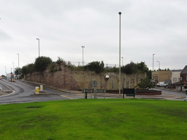
Image: © Nigel Thompson Taken: 28 Aug 2019
Opened in 1842 by the Brandling Junction Railway, later part of the North Eastern Railway, as the revised terminus of the line from Gateshead, it replaced an earlier terminus further south (see Image). It was shown as "Low station" on the 1855 Ordnance Survey map, and referred to as "Market Place" in some local newspapers. In turn, this station closed to passengers in 1879 when services were transferred to a new station (see Image) near the current Metro station. View south from the road towards the site, the buffers would have been near the top of the wall nearest the camera. The road on the left is Station Road, the one on the right is a later development that cuts through part of the station site. The rest of the site had become a car park when this image was taken, with no trace of the former station apparently surviving.
Images are licensed for reuse under creativecommons.org/licenses/by-sa/2.0
Image Location
Latitude
54.995114
Longitude
-1.438369